

Te Pokohiwi o Kupe sits on a stretch of the Marlborough coast, where rising seas threaten to wash away one of Aotearoa’s most important early settlement sites.
The gravel spit, widely known as the Wairau Bar, holds the remains of the first Polynesian settlers who arrived around 1300 AD, along with thousands of ancient items.
New scientific tools show that while about 20% of the site can flood during a big storm today, that number jumps to 75% if sea levels rise by one metre by the year 2100.
For the local iwi, Rangitāne o Wairau, the thought of the land going underwater is deeply worrying.
Dr Peter Meihana, a board member of Rangitāne o Wairau, says the iwi has spent years learning about the site as kaitiaki.
“So it’s been a very interesting last 15 years. And because we are the tangata whenua, the kaitiaki of this place, we want to know as much about it as possible,” Meihana said.
“What we’re starting to quickly learn is that Te Pokohiwi is now under threat of sea level rise.”
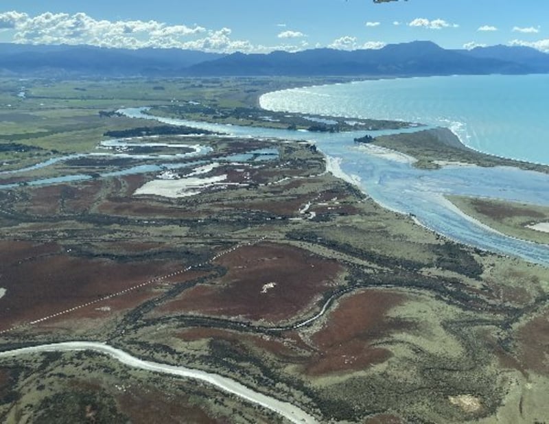
Centuries ago, the area was a busy food-gathering place where early ancestors caught fish and gathered resources.
“In the past, this was a popular fishing spot for the pātiki and īnanga,” Meihana said.
“For most people, they’ll recognise Te Pokohiwi, Wairau Bar, as the archaeological site. For us, it’s wāhi tapu.”
A history of loss and reclamation
The threats facing Te Pokohiwi o Kupe come after a long history of outsiders taking and disturbing the land.
In 1939, a 13-year-old schoolboy named Jim Eyles found a moa egg and old items at the site. That find led to big digs that took away human skeletons and cultural treasures, and some ended up on display in museums.
By the 1960s, Rangitāne closed off the site to protect what was left of their ancestors. Decades of hard work followed, leading the iwi to take their claims to the Waitangi Tribunal in 2003.
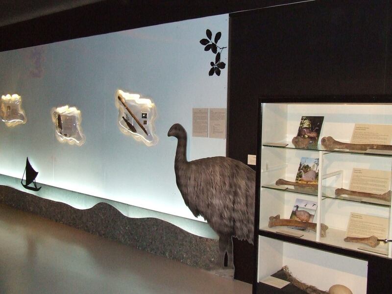
Before the land was handed back, an agreement let scientists test DNA and bones. In 2009, the ancestors were brought home to be buried again at Te Pokohiwi-o-Kupe.
After talks, the Crown and Rangitāne signed a settlement on December 4, 2010. This officially gave important pieces of land at the Wairau Bar back to the iwi so the public could no longer walk all over it. The spot was officially named wāhi tapu in 2012.
A new tech model to save their land
To figure out how bad the rising water could get, Rangitāne o Wairau teamed up with Earth Sciences New Zealand for two years to build a special computer map.
Corey Hebberd, who led the project, says the computer program looks at the height of the land and how water moves to map out future floods.
“At its simplest, it’s a computer model that scientists and researchers are able to use,” Hebberd said.
“It takes into consideration different terrain types, which parts of the site are the highest and which parts are the lowest, and then it gives consideration to things like sea level rise.”

Hebberd says what they learned helps not just this place, but historic sites across the whole country.
“It’s one of the sites that was first settled in the country,” Hebberd said.
“And so how we learn from that and how we protect what’s there and learn from it for the whole of the country and tell that story, it’s really important that we have consideration of the sea level rise and how that might impact the area.”