

A number of coastal marae in the Bay of Plenty are dealing with the direct effects of climate change and face the difficult prospect of having to move.
Ngāi Te Rangi chief executive Paora Stanley said marae along the coastline were experiencing the impact of rising sea levels, erosion and increasingly frequent extreme weather.
“We have several marae at risk in Otawhiwhi out near Waihī, Te Rereatukahia in Katikati, Maungatapu, Tahuwhakatiki out at Welcome Bay, Whareroa... around Opureroa on Matakana Island the bank is collapsing away.
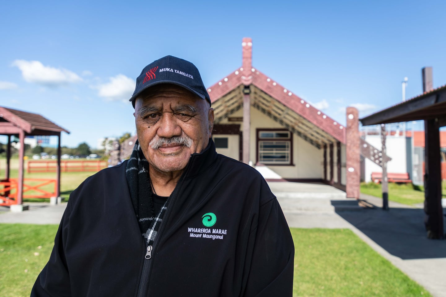
“Marae in low-lying areas, like Whareroa Marae, are where the possibility of uplifting and shifting to higher ground isn’t unusual.”
He said in the past, some marae had to be moved because of similar issues but it was a growing and more urgent problem.
At the iwi runanga, Stanley said they offered support to marae affected by climate change.
He said it was their job to correctly determine when it would become a danger, then help develop a plan, along with the individual marae, to deal with the changes they needed to make.
He believed there needed to be an active push to provide support and funding for all the marae affected by climate change.
Stanley said places like Whareroa and Maungatapu had also been a refuge for people in times of a Civil Defence emergency.
“They do such a big community assistance, there should be an opportunity for the community to give back.”
Maungatapu Marae, facing Rangataua Bay, was looking at where and how it would move, and Whareroa Marae near the Port of Tauranga was another with an uncertain future.
Future not looking good
Its chairman, Manea Ngātai, said they had been dealing with the same climate change issues and the future did not look good.
“If you get the manuhiri [visitors] to come on to the marae, they will be walking around in water and that’s no good,” Ngātai said.
“It’s all very well to have your whare way up in the air but what about the people walking around?”
Ngātai said Tauranga City Council had given them information indicating the sea level would rise to the treeline between their whare and the harbour within 20 years.
“[It is] not only us that have got this problem. Rangiawaea Island, Matakana, Maungatapu... all of the marae down the coast that are on the low are pretty close to the sea level.”
Likely to have ‘broader impact’
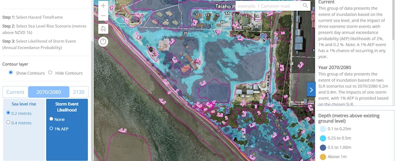
Tauranga City Council referred inquiries about the rising sea level at Whareroa to publicly available maps.
The image showed a prediction for 2070 to 2080 of what will be underwater if there is a conservatively estimated 0.2 metre sea level rise and minimal storm events.
Bay of Plenty Regional Council spokesman Chris Ingle said some coastal marae would be exposed to climate-driven hazards, including coastal inundation and coastal erosion, as well as flooding.
Ingle said it was also likely to have a broader impact on iwi and hapū's ability to gather food and carry out cultural practices on other cultural sites, such as urupā and papakāinga.
To support these communities, Ingle said they had launched a community-led adaptation planning initiative.
“Challenging conversations around climate change and coastal marae are best led by those communities themselves with the support of local government.”
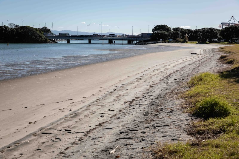
Ngātai said when the heavy rain flooded Whareroa during Cyclone Gabrielle, they found the lower parts of the land were badly affected but continual coastal erosion was also a big factor.
“Over the past two or three years it’s gradually getting eaten away.
“You can see the erosion down there where, on high tide, the water actually comes right up... and then it goes away - so I always keep an eye out.”
Ngātai said the marae would need to move to higher ground soon.