

I whakaputahia tuatahia tēnei ātikara e APTN News i Kanata.
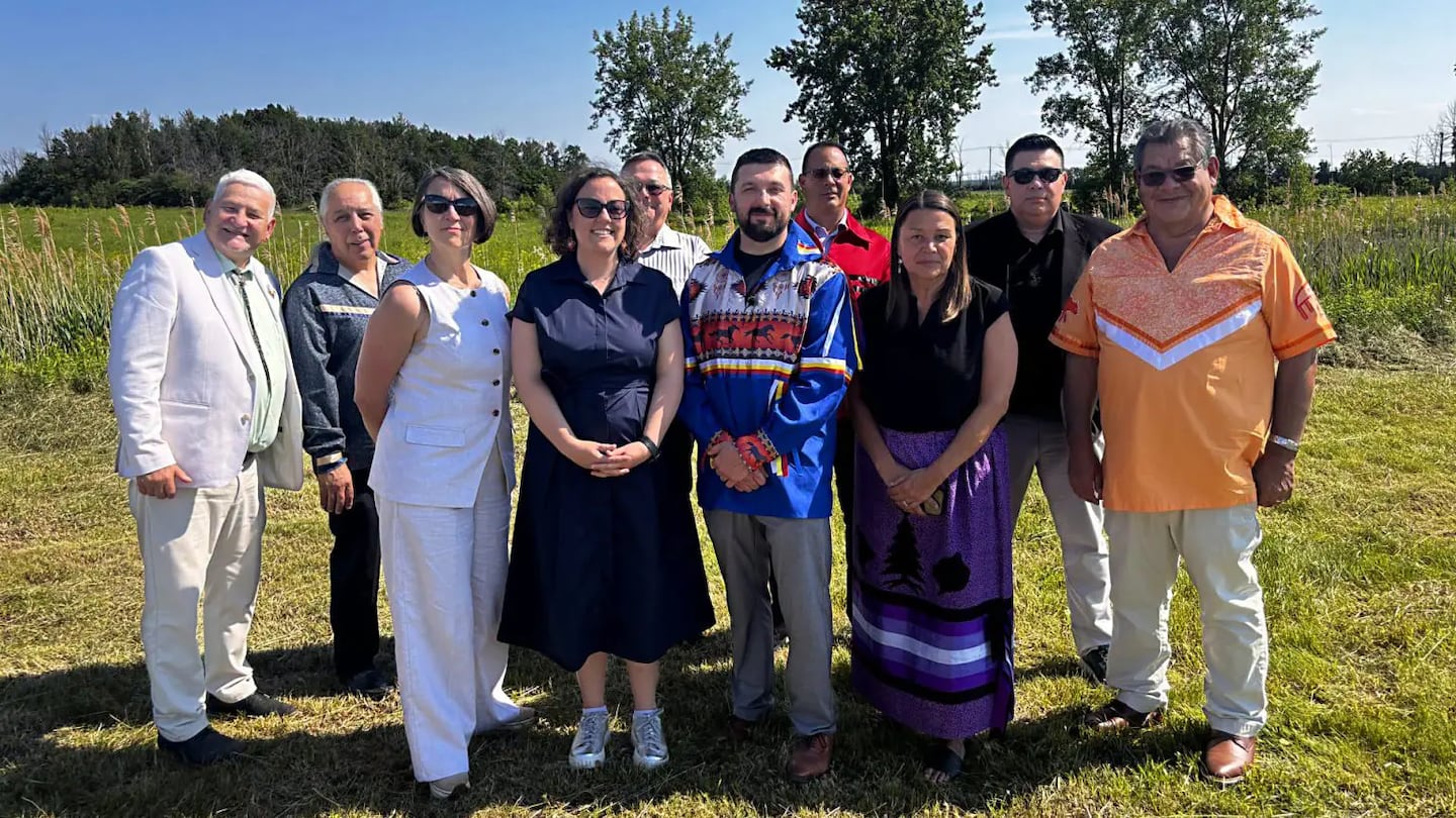
Grand Chief Cody Diabo of the Mohawk Council of Kahnawà:ke (MCK) said he hopes recent progress toward the federal government’s return of 162 acres of land to the people of Kahnawà:ke will inspire other First Nations to make plans of their own to get land back.
“Whatever we do is definitely going to pave the way for other nations in their journeys and in their fight to reclaim what is theirs,” Diabo told APTN News. “Whenever we do something it’s going to reverberate across Turtle Island and across all our brothers and sisters. I definitely hope that this is something that progresses in other forums, and people, other First Nations, reach out to us [to ask] ‘How did you do that?’”
The land in question is known locally as the “Old Radar Site,” and officially as the “St. Rémi federal surplus property.” For years it was owned and operated by the federal Department of Defence, before being transferred to the federal department of Innovation, Science and Economic Development. In 2019, the MCK expressed their interest in the property, which was in turn purchased by Crown-Indigenous Relations Northern Affairs Canada (CIRNAC) in 2022.
On June 29, CIRNAC Minister Rebecca Alty met with Grand Chief Diabo as well as Council Chiefs from MCK (known as Ratitsénhaienhs). During the course of the meeting, she announced $1.2 million ($1.48 million NZD) in funding to clean up the land and prepare it for use as farmland.
“Cleaning up the former radar site is an important step toward restoring this land for the benefit of the Kahnawà:ke community,” Alty said in a press release. “By supporting decontamination efforts, we are strengthening our partnership with the Mohawk Council of Kahnawà:ke and supporting its stewardship of lands and resources, helping create a safer, healthier environment for future generations.”
Diabo hailed the deal, saying, “These next steps in this process mark a vital advancement in our Land Back efforts, ensuring that this land is restored and meets appropriate environmental standards. Reclaiming this land is a powerful, historic step forward for our community.”
The Old Radar Site and the Seigneury Grievance
The Old Radar Site is just outside the greater area covered by the Seigneury of Sault St. Louis (SSSL) Land Grievance, a claim by which the MCK asserts its historical right to 23,928 acres of unsettled land along the south shore of the Saint Lawrence River.

The original Seigneury of Sault St. Louis was an estate granted by the French Crown to the Jesuits in 1680 for use by the “Iroquois of the Sault,” an early European name for the Mohawks of Kahnawà:ke. Over time, however, much of the land in the SSSL has been given away. That process began in the 18th century, as the Jesuits gave portions of the lands to French settlers, despite protests by Mohawks.
Over subsequent centuries, generations of Kahnawà:ke leadership continued to protest the dispersal of the SSSL lands, with little success. Under subsequent British rule, and then Canadian rule, the SSSL was subject to further erosion. In the 1990s, the MCK and the federal government began meeting to discuss the SSSL, and since 2003 they have negotiated over the land, which the MCK refers to as “the Seigneury Grievance.”
In recent years, the MCK has launched the “Still Ours” campaign to inform both Kahnawà:ke residents and neighbours in surrounding communities of MCK’s assertion that the lands identified under the SSSL Grievance remain property of Kahnawà:ke.
Simultaneously, Diabo told APTN, shifts in the federal government following the election of Prime Minister Mark Carney last year created ideal relationships to move the project forward.
“Bringing the minister on a tour of where the Seigneury Grievance is,” Diabo explained, “letting her see the amount of development happening, showing a parcel that is undeveloped right now that we would like to return back to the community that needs to be returned back, definitely helped push us to this point.”
The Old Radar Site is outside the historical grievance area, noted Council Chief Ross Montour, but it abuts it. When the MCK initially began pursuing the site, the forms of claims available were either specific claims, which would have given Kahnawà:ke money but not land, and comprehensive claims, which were related to self-government.
The radar site, Montour told APTN, “was neither of those things. The one thing that Kahnawà:ke has always been consistent about politically, in terms of the approach, has been ‘We’re pushing the boundaries.’ It’s a grievance or a claim of a third order. We’re not using that template for specific claims. The intention is to get that whole land quantum back, there’s over 24,000 acres. But how we get it, where we get it, those are things that we’re about to begin.”
Both Diabo and Montour stressed Kahnawà:ke is concerned about food security, and plans to use the land of the Old Radar Site for farmland. Diabo said the Council is hopeful that by August or September, the former Old Radar Site will formally become Kahnawà:ke Reserve Number 14.
While the Additions To Reserve (ATR) process is being finalized, the MCK wants to have community members out on the land. Diabo said the agreement would help make sure they would not be bothered on the land by provincial or federal authorities.
Getting ready for farming
Until then, Diabo said the MCK hoped to get the land ready. He said despite the wording of some statements, the ground itself is not contaminated and is safe for farming. The building on the site was built in the 1940s, and contains lead paint, asbestos and oil, so must be removed carefully. In recent years, unknown parties have also dumped construction debris and soil on the site. But Diabo said the land itself can be remediated easily, and is nearly ready for crops.
“We’re taking that on as MCK, and we have the expertise and the resources to do it,” Diabo said. “It’s a lot easier for us to come up with a contract, go up for tender, hire the person, they do it, then the federal government can [pay for it].”
Diabo’s hoping the remediation work will be finished in time for the community to plant a winter crop, though he said it’s important to engage with members and find out what kinds of farming they’d like to see. Accordingly, he said they may wait until spring for the first planting.
“We’ve already heard people talk about orchards, planting new maple,” he said. “And then regular planting as well. But you’ve got to make sure that what you’re planting next to each other goes well with each other. And we have to be cognizant of the farmers around us, because they use a specific type of seed for their use. We have our own traditional seeds. We want to make sure that there’s no cross-contamination [with crops in neighbouring farms].”
The MCK is open to partnerships with neighbouring farmers, whether for renting equipment, sharing land or exchanging knowledge. However, Diabo said the goal for the Old Radar Site land is traditional farming.
“We do a lot of companion planting,” he said. “Traditionally we did our three sisters: corn, beans and squash. Each one complements one another. On the outside, it’s all monocropping. You do your pesticides and your fertilizers and all that kind of stuff. And that’s something that we also don’t want in our territory. We want to plant the way we plant and make sure it’s sustainable.”
Next steps, and next tracts
Montour noted the MCK is still unsatisfied with the delay in processing land returns to First Nations. He noted that when Alty visited the community, she was present both for a ceremony on site as well as a Council meeting.
“One of the things that we did was to impress on her that particularly, there’s no real reason for an ATR to take 10 years,” Montour said. “They really need to work on the expedition of that. I think our sense of the minister is that she was sympathetic to what we were saying. Of course, the proof is in the pudding.”
As the community has waited for land to be formally returned, Montour said, they’ve lost other pieces of territory.
“Within my lifetime,” he recalled, “the St. Lawrence Seaway Project, the rail lines before that, the hydro lines: we have already lost a lot of land, even within the existing boundaries of what’s now Reserve 14. In our community, you’ll see the signs around, ‘Not one more inch.’”
Diabo said the community is eyeing a number of parcels that are designated “federal surplus land.”
“Definitely we are looking,” he said. “And the main focus from Kahnawà:ke is the land that’s within the Seigneury Grievance. That’s the land that we’re coming back for.”
Montour noted the federal government is aware that every time they sit down with the MCK, other Nations are watching and considering what they could do to get the same results.
“We’re proud of that,” Montour said. “We are responsible for looking after the needs of our community. We’re glad to inspire other First Nations, you know. But the thing is, it needs to happen. If there’s any truth to the United Nations Declaration on the Rights of Indigenous Peoples legislation, then this is appropriate to happen.”
Diabo concurred, saying he’d like to see other First Nations apply the model that Kahnawà:ke is developing.“People reaching out to us, other First Nations—we’re always open to having those discussions with them. We’re more than happy to work together and open up those communication channels, communicating to First Nations across Turtle Island. We’re here to provide insight, to give information to our brothers and sisters out there.”
Nā Jesse Staniforth nō APTN News.